|

|

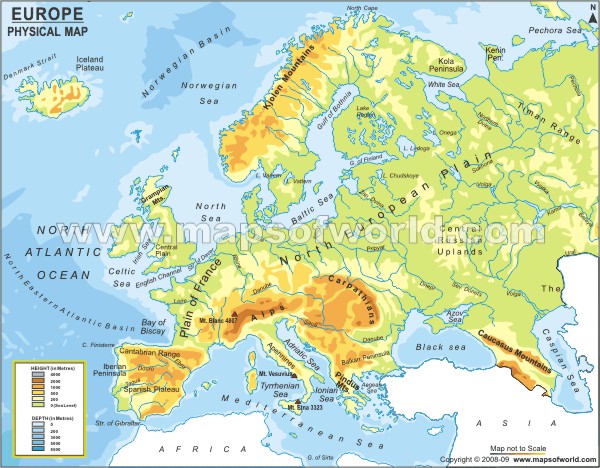
The Physical Map features affected human settlement , because some people may not want to live by large body of water and mountains.Settlers need water, they often locate on wet point sites for this. Settlements built away from rivers and water supplies to avoid flooding are located at drypoint sites.
|

Homes in Eastern Europe were arranged in a circle but there were no boundary around the village to keep people from coming into the village. English villages were very small so not much people lived there.Over time the landscape changed as the number of european communities increased.
|

The Historical Map change over time because the tectonic plates rub together and made Pangea. It includes statistical tables of religion, population, surface area, and military personnel. Borders change as new territories are founded. When wars end and peace treaties sign over land to countries borders are changed. Over time borders are changed by rivers and natural landforms.

Eastern Europe Rivers -
- Belarus Rivers -Neman,Narew,Bug River,Poltsk Lowland,
- Bulgaria Rivers- Iskar,Ropotamo,Rezovska River
- Czech Rivers- Elbe,Oder,Vltava
- Hungary Rivers- Danube,Tisza,Ipel
- Poland Rivers - Vistula,Warta,Oder
- Moldova Rivers -Danube Rivers,Dniester River
- Russian Rivers- Volga River, Ob River,Ural River
- Romania Rivers- Olt River,Danube River,Somes River
- Slovakia Rivers-Vah River,Danube River,Hron River
- Ukraine Rivers- Dnieper River,Dniester River,Danube River
